What is Fire Rebuild?
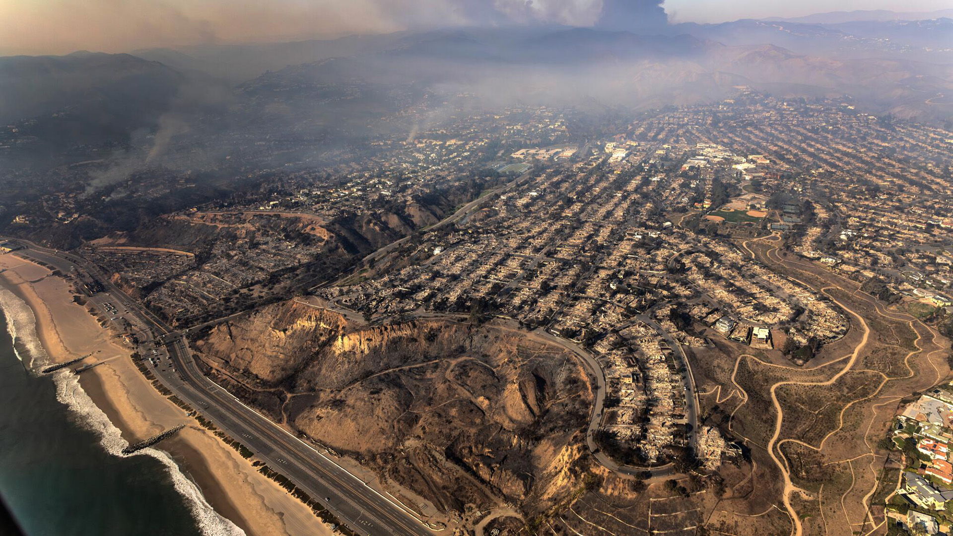
Fire Rebuild is the dedicated platform for documenting and providing the definitive historical reference of the Palisades Fire, the worst unnatural disaster in the history of California. This site serves as a permanent archive ensuring the truth is preserved for future generations.
Origin
Fire Rebuild was initially established to expose the documented corruption, malfeasance, and intentional infliction of emotional distress directed at fire survivors by city employees. Born out of deep frustration with California’s unequal treatment of its citizens, the initiative began when it became clear that while some residents were forced through years of bureaucratic red tape, others received preferential treatment despite violating building codes and laws.
Fire Rebuild is not affiliated with any government agency and does not represent municipal, state, or federal authorities. We stand for transparency, justice, and recovery.
Original Proprietary Content
Michael Kureth disproved false narratives claiming that hurricane-force winds, unprecedented conditions, and climate change had a substantial impact on the Palisades Fire. His reports from early and mid-2025 inspired and initiated federal investigations into the cover-up of the fire.
HURRICANE-FORCE WINDS
Palisades Fire:
Weather Report and Analysis
Unprecedented Failure, Not Unprecedented Conditions: Palisades Fire Proven to Result Not from Climate Change, but from Negligence and Incompetence
View Report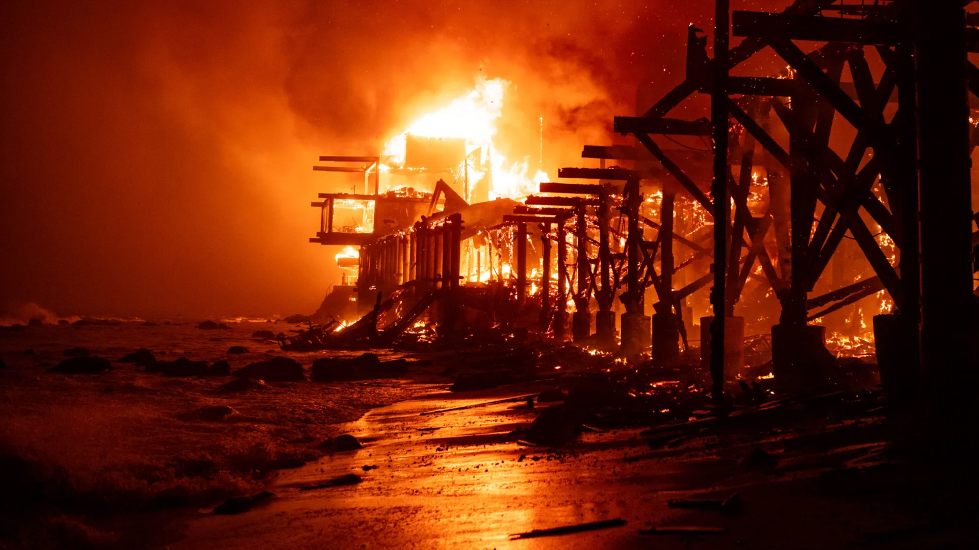
UNPRECEDENTED CONDITIONS
Palisades Fire:
Burn Risk Report and Analysis
Palisades Fire Proven to Be an Unnatural Disaster. Misrepresenting this as a “Natural Disaster” will encourage similar outcomes and greater fire risk in the future.
View Report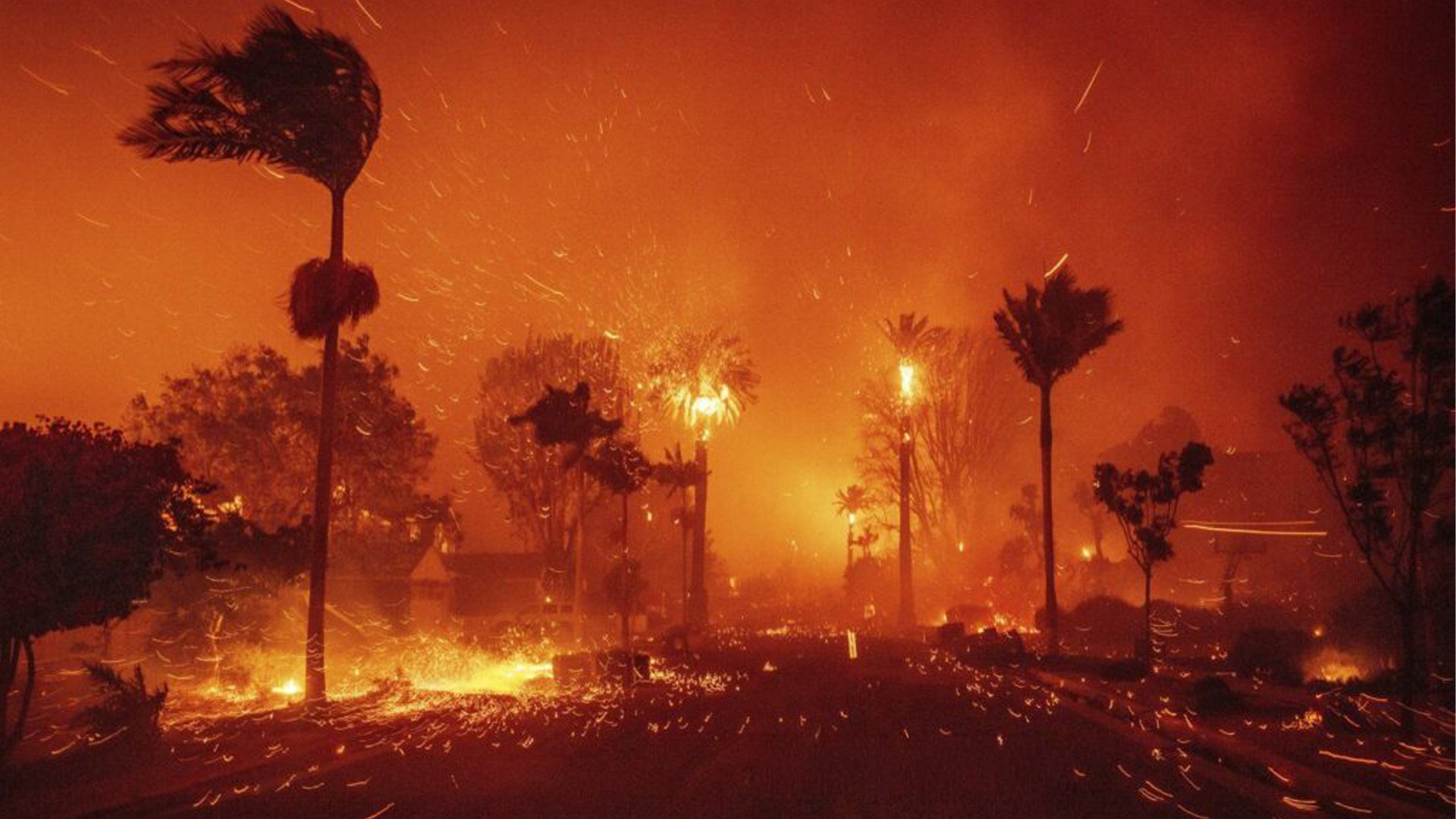
CLIMATE CHANGE
Palisades Fire:
Fire Risk Comparative Analysis
No One Cares That Pacific Palisades Was Destroyed Even Though the Majority of Californians Face Equal or Greater Fire Risk.
View Report2025 Palisades Fire Fact Sheets
This section presents verified facts about the 2025 Palisades Fire, researched and confirmed by Michael Kureth (Fire Rebuild). All verified facts are publicly available and supported by evidence. No private information, non-disclosure agreement (NDA) materials, or details from private lawsuits are included.
Victims of the 2025 Palisades Fire have endured a historic atrocity and deserve justice. These facts document a pivotal event in history, one that must never be concealed, distorted, or forgotten.
Selected Fact Sheet:
| 2025 Palisades Fire Fact Sheet - Weather | ||||
|---|---|---|---|---|
| Claim | Fact Check | Evidence | ||
| A001 | 100 MPH Wind Speeds | FALSE | No weather station in Los Angeles County recorded 100 MPH wind speeds on January 7, 2025 | Wind Report |
| A002 | 100 MPH Wind Gusts | FALSE | No weather station in Los Angeles County recorded 100 MPH wind gusts on January 7, 2025 | Wind Report |
| A003 | Hurricane Force Winds | FALSE | No weather station in Los Angeles County recorded sustained wind speeds of at least 75 MPH on January 7, 2025, a speed that would meet the minimum definition of a Category 1 hurricane | Wind Report |
| A004 | Historical Drought Conditions | FALSE | California has records of longer droughts prior to the period before January 7, 2025 | Precipitation Records |
| A005 | Historical Drought Preceded by Unprecedented Rains | FALSE | California has records of more precipitations preceding longer droughts prior to the period before January 7, 2025 | Precipitation Records |
| A006 | Unprecedented Wind Event | FALSE | California describes the predicted and precedented seasonal winds as "Santa Ana winds" which have been recorded at far greater speeds for decades preceding January 7, 2025 | Wind Report |
| A007 | Unforeseen Weather Conditions | FALSE | The National Weather Service forecasted Santa Ana winds and warned of the forecasted fire risk on January 3, 2025 at 6:55am, at least 99 hours before the 2025 Palisades Fire | Forecasts and Warnings |
| A008 | Unprecedented Weather Conditions | FALSE | Los Angeles County has mitigated far greater fire risks just within 5 years prior to the 2025 Palisades Fire | Fire Risk Report |
| A009 | Unprecedented Perfect Storm | FALSE | Los Angeles County has mitigated far greater fire risks just within 5 years prior to the 2025 Palisades Fire | Fire Risk Report |
| A010 | Record Breaking Fire Risk | FALSE | Historical records for Pacific Palisades, dating back to 1979, show hundreds of days with a far greater fire risk than was present during the 2025 Palisades Fire. | Fire Risk Report |
| A011 | Weather stations are omitted in the Wind Report | FALSE | All weather stations within a 20 mile radius of Pacific Palisades are included in the report and analysis. Again, no weather station recorded 100 mph winds, 100 mph gusts, or hurricane force winds on Jan 7, 2025. | Wind Report |
| A012 | Only "hobbyist" weather stations are in the Wind Report | FALSE | All weather stations, including federal and state owned as well as public news stations and independent "hobbyist" stations are included in the report. Again, no weather station recorded 100 mph winds, 100 mph gusts, or hurricane force winds on Jan 7, 2025. | Wind Report |
Interactive Map
Developed by Michael Kureth and hosted on FireRebuild.com, the Interactive Map provides wind and fire perimeter data along the timeline of the Palisades Fire.
Tue Jan 07 2025(12:00 AM)
Select Date
Select Time (15-min intervals)
12:00 AM11:45 PM
Size (Acres):
0
Last Updated:
No Fire Reported
Elevation:
692
"They Let Us Burn" - Palisades Fire Anniversary
On January 7, 2026, exactly one year after the catastrophic Palisades Fire, residents rallied in the heart of the Pacific Palisades to demand accountability for a total breakdown in prevention, precaution and leadership from the City of Los Angeles, State of California, LADWP, LA Fire Officials, California State Parks, California Natural Resources Agency, state/local agencies, Governor Newsom, and Mayor Bass. Despite promises of action, city and state leadership and agencies have delivered little real progress, with limited vision or a clear plan paired with great uncertainty.
This speech is from Jeremy Padawer (Palisades Fire Survivor / Rally Organizer / PacificPalisades.com).
For more information, visit TheyLetUsBurn.com.
CURRENT SPEAKER:Jeremy Padawer — Palisades Fire Survivor / Rally Organizer
SWITCH VIEW: